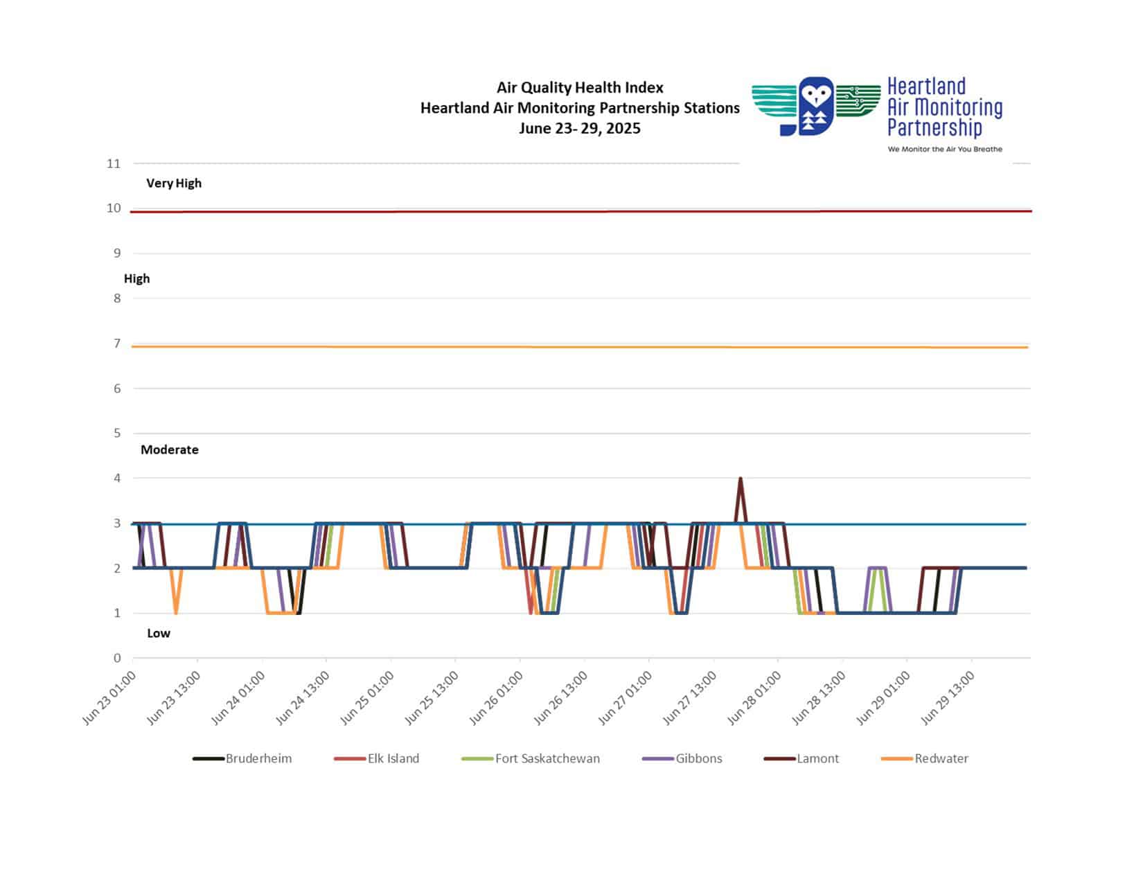
Light snow continues through the afternoon before tapering off to a chance of flurries this evening. Temperatures remain well below seasonal, with brisk winds making it feel even colder overnight. Sunday brings a mix of sun and cloud along with increasing winds, offering a slight break from the cold. The start of the week sees gradual warming, though clouds will build ahead of another round of snow by midweek. By Friday, temperatures are expected to climb closer to seasonal, bringing a more spring-like feel to Alberta’s Industrial Heartland.
Today Periods of light snow ending this afternoon then mainly cloudy with 30 percent chance of flurries. Wind up to 15 km/h. High minus 4. Wind chill minus 11 this morning and minus 6 this afternoon. UV index 2 or low.
Tonight Cloudy with 30 percent chance of flurries this evening then partly cloudy. Wind up to 15 km/h. Low minus 13. Wind chill minus 6 this evening and minus 16 overnight.
Sun, 30 Mar A mix of sun and cloud. Wind becoming southeast 20 km/h gusting to 40 near noon. High zero. Wind chill minus 16 in the morning. UV index 3 or moderate.
Night Clear. Low minus 8.
Mon, 31 Mar Increasing cloudiness. High plus 3.
Night Cloudy. Low minus 4.
Tue, 1 Apr A mix of sun and cloud. High plus 4.
Night Periods of snow. Low minus 4.
Wed, 2 Apr Periods of snow. High zero.
Night Cloudy periods. Low minus 6.
Thu, 3 Apr A mix of sun and cloud. High plus 4.
Night Cloudy periods. Low minus 4.
Fri, 4 Apr A mix of sun and cloud. High 8.