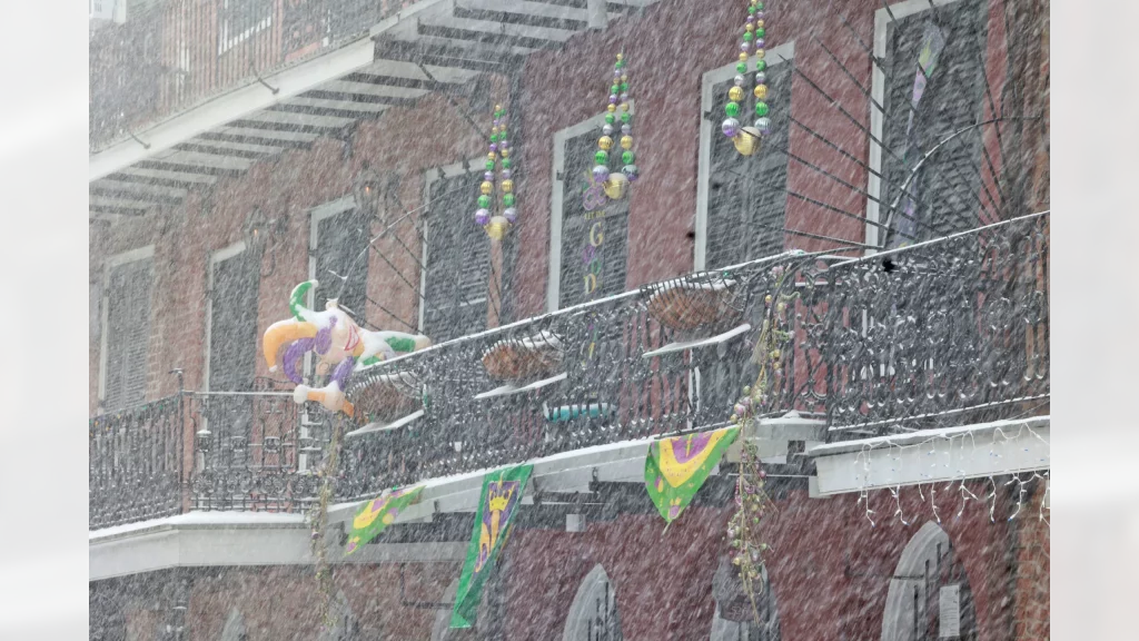
At the time of writing, it’s the same temperature here—minus 5—as in New Orleans…and it’s a lot less snowy here. Let that sink in for a minute.
The good news is that the forecast here doesn’t include any accumulations of snow like they got in the Big Easy, and the better news is that the above normal temperatures will continue into next week. Wednesday will see a few flurries and a high of -2. Clouds will roll in overnight, but will clear out Thursday afternoon on our way to a high of 3 degrees. The extended forecast still calls for a high of 11 glorious degrees on Monday. I’m sure N’awlins would like a piece of that action.
If NOLA lives up to its reputation, the people will laissez les bon temps roulez for every bit of their once-in-a-generation winter wonderland.
Today A few flurries ending this morning then clearing. Wind northwest 20 km/h gusting to 40. High minus 2. Wind chill minus 12 this morning and minus 4 this afternoon.
Tonight Clear. Increasing cloudiness overnight. Wind up to 15 km/h. Low minus 6. Wind chill minus 8 this evening.
Thu, 23 Jan Cloudy. Clearing early in the afternoon. Wind becoming northwest 20 km/h in the afternoon. High plus 3. Wind chill minus 7 in the morning.
Night Clear. Low minus 6.
Fri, 24 Jan Sunny. High minus 1.
Night Clear. Low minus 7.
Sat, 25 Jan Sunny. High zero.
Night Clear. Low minus 4.
Sun, 26 Jan Sunny. High plus 5.
Night Cloudy periods. Low plus 1.
Mon, 27 Jan A mix of sun and cloud. High 11.
Night Cloudy periods. Low minus 4.
Tue, 28 Jan A mix of sun and cloud. High plus 2.


